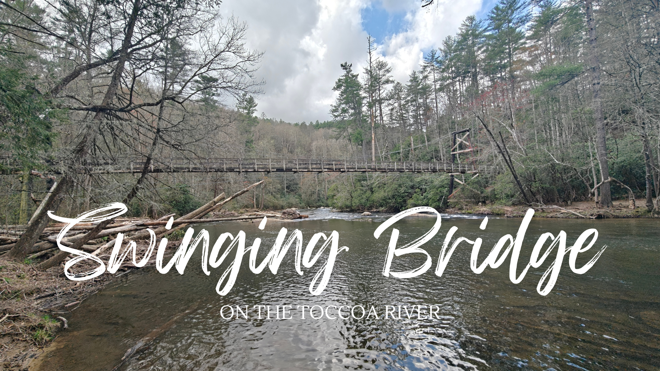
A kind lady in a local antique shop suggested that visit a swinging bridge. Well, okay, why not?
Finding the Bridge
She mentioned the bridge was near a fish hatchery and that was easily found on Google Maps. The bridge was a tad less obvious. Driving from Morganton to the hatchery, we happened across a sign for the bridge.
We like to hike so first instinct was to hike to the bridge. We looked at the steep dirt gravel road and asked someone who was trying to drive it.
The Google Street View is an optimistic look at the road. While most of it wasn’t that bad, the initial ascent was deeply rutted and washing out.
The Benton MacKaye Trail intersects with Morganton Highway and the gravel road. Its approximately 3 miles by trail back to the bridge. Nope, never mind.
We loaded the kids up and took Kevin (our faithful Expedition) back. The road was often wide enough for only one car but had plenty of pull offs available.


A 20 minute drive eventually delivered us to a “parking lot” a short walk from the bridge.

A sign at the end of the parking lot shows the way to the bridge as well as the Benton MacKaye Trail. A well worn trail heads downhill to the bridge. Boots wouldn’t hurt but kids make it in Crocs.


Overall, I’d recommend visiting Swinging Bridge. Its an interesting diversion and the surrounding area is beautiful. An autumn visit would be impression though the summer could be nice for a chance to cool off in the river.
There is also plenty of space around the river for a picnic.
Leave a Reply